What Are the Nazca Lines?
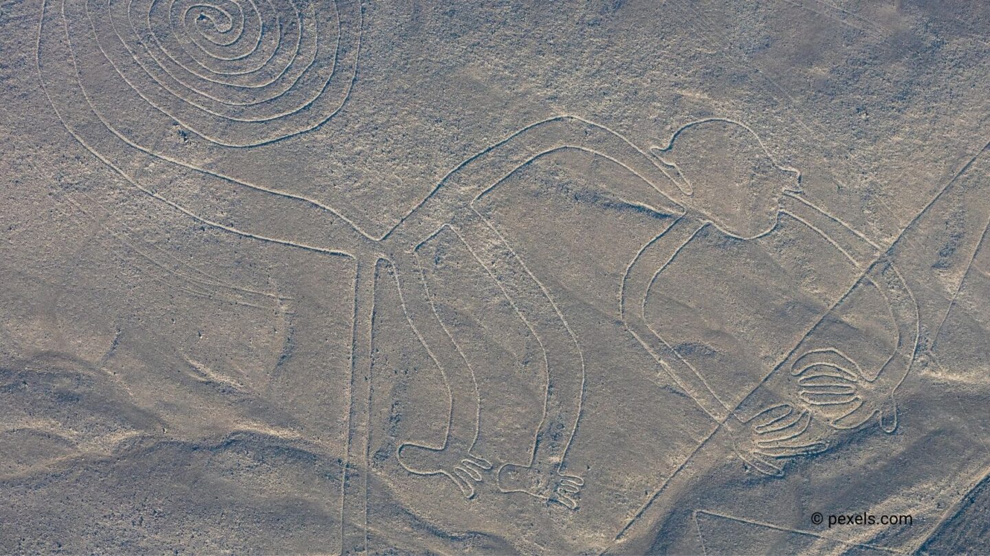
The Nazca Lines are one of the world’s most fascinating and mysterious archaeological wonders. Located in the Nazca Desert of southern Peru, these massive geoglyphs were created by the Nazca civilization between 500 BCE and 500 CE. Spanning hundreds of square kilometers, the lines form intricate shapes, including animals, plants, and geometric patterns.
Visible primarily from the air, the Nazca Lines were etched into the arid desert soil by removing the reddish surface rocks to expose the lighter ground beneath. The lack of wind and rain in the region has preserved the lines for centuries, making them a unique and enduring legacy of an ancient culture.
Theories About Their Purpose
The true purpose of the Nazca Lines remains a subject of debate among scholars. Several theories have been proposed, ranging from religious and astronomical functions to practical uses. Here are some of the most compelling ideas:
- Astronomical Alignments: One of the earliest theories suggests that the Nazca Lines served as an astronomical calendar. German archaeologist Maria Reiche proposed that the lines were aligned with celestial events, such as solstices and equinoxes, and helped the Nazca people track seasons for agricultural purposes. However, further studies have cast doubt on this idea, as many lines do not correspond to specific celestial alignments.
- Ritual Pathways: Another theory is that the lines were part of religious rituals. Archaeologists believe that the Nazca people may have walked along these paths during ceremonies to honor their gods, particularly those associated with water and fertility. This interpretation is supported by the desert’s harsh environment, where water was essential for survival.
- Symbolic Communication with the Gods: The geoglyphs, particularly those depicting animals like the hummingbird, spider, and monkey, may have had spiritual significance. Some researchers believe the designs were created to communicate with deities or to appeal for blessings, such as rain for their crops. The sheer scale of the lines suggests they were meant to be seen from above, perhaps by divine beings.
- Marking Water Sources: A more practical theory proposes that the lines were used to map underground water sources. The Nazca people were skilled engineers who built aqueducts to irrigate their fields, and the lines may have served as markers for these water channels.
Challenges to Understanding the Lines
Interpreting the Nazca Lines is challenging due to the limited information available about the Nazca culture. The Nazca people left no written records, and much of what we know about them comes from pottery, textiles, and the geoglyphs themselves. Additionally, the lines’ sheer scale makes it difficult to study them in their entirety without aerial or satellite images.
Modern technology, including drones and ground-penetrating radar, has provided new insights into the lines’ construction and the surrounding environment. However, definitive answers about their purpose remain elusive.
A Legacy of Mystery and Intrigue
The Nazca Lines continue to captivate the world with their scale, precision, and mystery. They serve as a testament to the ingenuity and creativity of the Nazca civilization, demonstrating their ability to manipulate the landscape in extraordinary ways.
While we may never fully uncover the purpose of the Nazca Lines, their enduring mystery reminds us of the richness and complexity of ancient cultures. Whether they were intended for practical use, religious devotion, or celestial observation, the lines remain one of humanity’s most intriguing puzzles, connecting us to a distant and enigmatic past.
